Getting Around · Our pick in Singapore
Sentosa Express
VivoCity to Sentosa
The monorail from VivoCity across to Sentosa’s stations.

Photo Credit
Image courtesy of © SgTransport · CC BY 2.0 via Wikimedia CommonsAbout Sentosa Express
The Sentosa Express runs from VivoCity to stations on Sentosa (sentosa.com.sg).
Our take

- To Sentosa
- Address
- HarbourFront, Singapore
- Nearest station
- HarbourFront
150 m · 2 min walk
More distances - Website
- sentosa.com.sg
Opening hours, prices and seasonal openings change, so please check with Sentosa Express before you go.
Last checked: October 2026 How we choose
What’s nearby
Distances from Sentosa Express are approximate, measured in a straight line (as the crow flies). Times are approximate too: walking at about 80 metres a minute, cycling at about 12 km/h and driving at typical city-traffic speeds. Traffic and routes vary.
Nearest MRT stations
- HarbourFrontCircle LineNorth East Line150 m2 min walk
- KeppelCircle Line1.2 km14 min walk
Key sights
- Sri Mariamman Temple3.3 kmWalk 41 minCycle 16 minCar or taxi 14 min
- Merlion Park4.4 kmCycle 22 minCar or taxi 17 min
- National Gallery Singapore4.4 kmCycle 22 minCar or taxi 17 min
- ION Orchard4.5 kmCycle 23 minCar or taxi 17 min
- Gardens by the Bay4.8 kmCycle 24 minCar or taxi 18 min
- Raffles Singapore4.9 kmCycle 25 minCar or taxi 18 min
- Singapore Botanic Gardens5.2 kmCycle 26 minCar or taxi 19 min
- Masjid Sultan5.9 kmCycle 29 minCar or taxi 21 min
- Jewel Changi Airport21 kmCar or taxi 63 min
Main railway stations
- Woodlands Train Checkpoint (to JB Sentral)21 kmCar or taxi 62 min
Location
The map comes from Google Maps, which sets its own cookies once it loads.
Read next
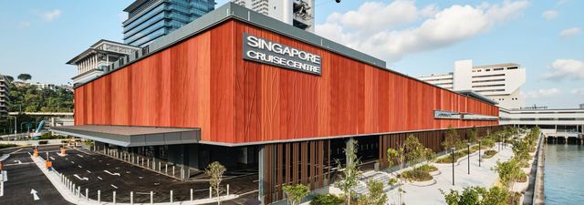 Getting AroundSingapore Cruise Centre: HarbourFront and Tanah MerahThe ferry terminals at HarbourFront and Tanah Merah for the Indonesian islands.
 ShoppingVivoCitySingapore’s large harbourfront mall, where the Sentosa Express leaves for the island.
 Getting AroundSingapore Cable CarThe cable car from Faber Peak across the harbour to Sentosa.